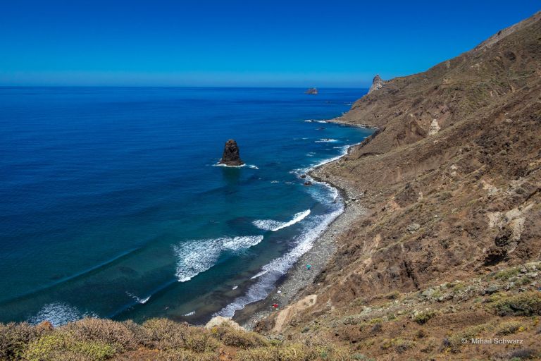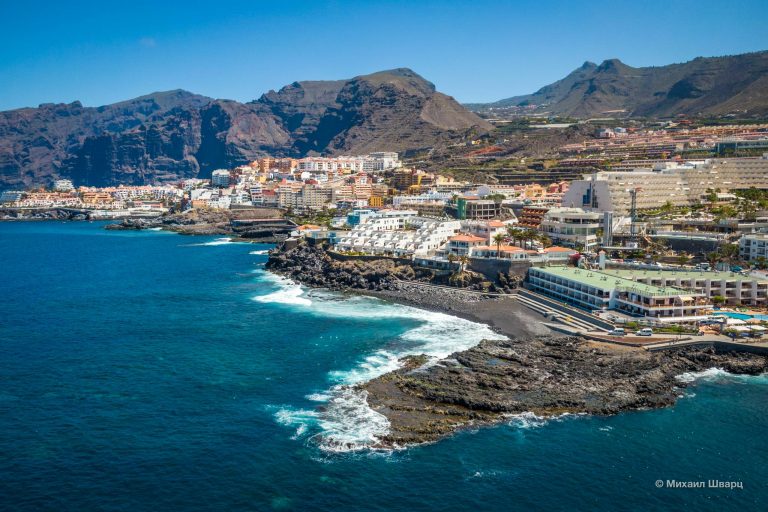
The Canaries are a fairytale archipelago, surrounded by the azure waters of the Atlantic. The islands are renowned for their pleasant weather. This is a land of eternal spring. However, people come here not only for beach vacations. The Canary Islands have actual «wonders of the world» – unique natural and man-made monuments, fantastical landscapes.
Timanfaya Park on Lanzarote
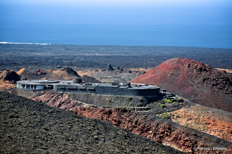
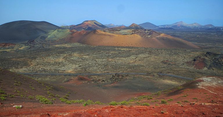
In the southwest of Lanzarote, the easternmost and most enigmatic Canary Island, lies Timanfaya National Park. This is a reserve of «fire-breathing mountains» – dormant and extinct volcanoes. The most recent powerful eruptions shook Lanzarote in the period 1730–36. Then the fertile fields and valleys were completely destroyed. Today, the island’s soil is hidden under solidified, lifeless basalt flows. The area of Timanfaya Park is over 5 hectares – almost the entire lava-covered area of the island was included in the reserve. The landscapes here amaze and shock observers with how similar they look to Mars: the land is scorched, there is almost no greenery, no birds sing. The harsh beauty is breathtaking.
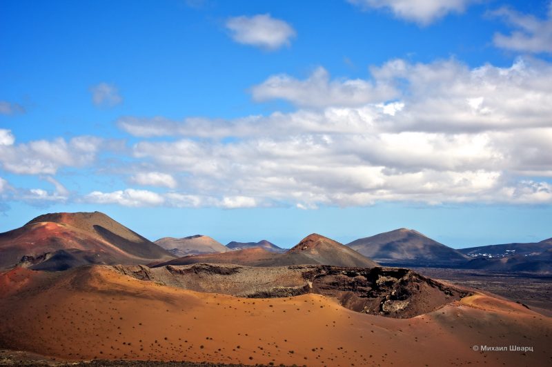
Tourists admire the ocher and black-red landscapes, visit the unusual El Diablo restaurant operating over a crater. Independent walks in the protected area are prohibited: only organized tours along specially laid routes are allowed. The island’s terrain hides many funnels and underground caves that one could easily fall into. Heat emanates from the ground: literally underfoot, under a thin layer of stony soil, seethes the fire-breathing volcanic force.
Timanfaya Park can be reached by rented car or bus from the village of El Golfo. Cars are left in a designated parking lot. Bus tours with audio guides depart from the park every quarter hour; pedestrian routes and camel rides are also organized.
The «Underwater Cemetery» Las Cruces de Malpique near La Palma
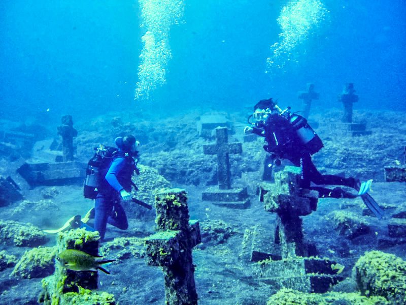
Underwater, off the southern tip of the green island of La Palma, lies a large memorial complex. Here rest forty true believers – Catholic priests who found their final resting place in the ocean. In 1570, the ship «Santiago,» carrying Jesuit missionaries led by Ignacio de Azevedo to Brazil, was boarded by French pirates. The leader of the Protestant raiders was Jacques Sore. The pirates mocked the Jesuits, forcing them to renounce the Catholic faith in exchange for their lives. The threats did not break the monks – the Huguenots killed them and threw them overboard. In 1999, the residents of La Palma installed forty crosses on the seabed in memory of the feat of true faith. The tombs stand at a depth of 25 meters, attracting divers and photographers. Las Cruces de Malpique is a biosphere reserve and a UNESCO site. It is home to turtles, moray eels, barracudas and huge groupers. Diving is only possible in calm weather when the sun is shining.
The Las Cruces dive site is located in the sea off Punta Malpique cape, at the start of the Costa el Faro road. The landmark is the Faro de Fuencaliente lighthouse, set at the southernmost point of La Palma island.
The «Organ» of La Gomera Island – Los Organos Rock
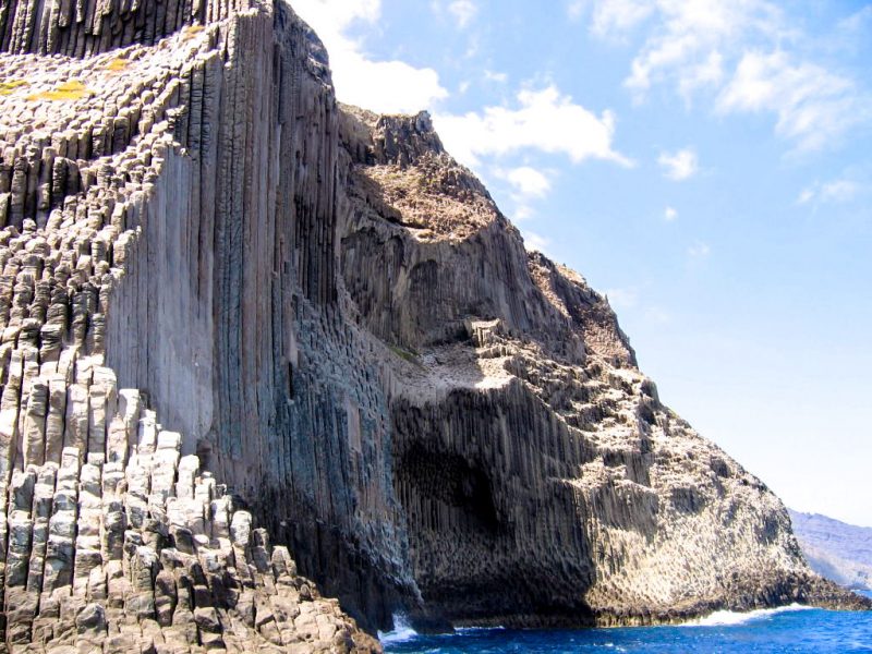
The unique «sculptural composition» of Los Organos can only be seen from the water on the northern coast of the misty La Gomera island. The rock walls, resembling thousands of silent organ pipes, plunge steeply into the ocean. Foamy waves crash against this impregnable vertical bastion. Here, lava flows petrified after a powerful eruption. Over centuries, water and wind gradually eroded the basalt, carving the rock into countless vertical columns reminiscent of a huge church organ. The height of the Los Organos cliff reaches 800 meters. The total area of the natural monument is 150 hectares. It is fenced off, and cannot be approached from land.The rock formation is located near the town of Valverde. Tourists take hired boats from the resort towns of Playa de Santiago and Valle Gran Rey to see Los Órganos: the excursion routes skirt around La Gomera along the eastern coast. From the sightseeing boats, there are impressive panoramic views of the coastline, towns, and bays. On the way, tourists often spot whales and dolphins.
The Canarian Juniper – a Relict Tree of Sabina de El Hierro

On the farthest island of the archipelago, tiny El Hierro (El Hierro), there is no diversity of hotels and tourist hustle and bustle. People don’t come here for comfort – but for vivid impressions. El Hierro is visited by lovers of pristine nature, tranquility, unusual landscapes, diving, and ecotourism. The island’s fame is due to the relict juniper forests of El Sabinar – a nature reserve at the top of a volcanic massif, on the mountain plateau of Dehesa. The highest point of El Hierro is adorned by the ancient Canarian juniper Sabina de El Hierro (Sabina de El Hierro) – the symbol of the island, majestic and gloomy, twisted by the wind and leaning down to the ground. On the way to the summit of La Dehesa, where the wonder-trees grow, there are views of the fantastically beautiful El Golfo valley and a panorama of the entire small island.
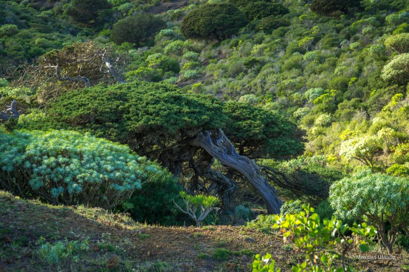
To reach the natural monument Sabina de El Hierro, you need to take the HI-500 highway (it is located on the western edge of the island, a few minutes’ walk from the parking lot).
The Unique Lunar Landscape on Tenerife

Near the high-altitude settlement of Vilaflor, the highest inhabited place on Tenerife (Tenerife), there is a rocky landscape of an unusual structure. The mountain formation «Lunar Landscapes» (Lunar Landscape) arose at the time of the eruption of Teide. Today, amidst the slope overgrown with Canarian pines, bizarre rounded light-colored peaks rise up. The lava, frozen in the shape of cones, resembles an alien relief in the vision of science fiction filmmakers (this area has indeed served as a location for movies more than once). On the way to the summit, observers from different angles get views of the majestic Teide, the southern coast of Tenerife, the peak of the neighboring Gran Canaria, and the outer part of the Las Cañadas caldera.
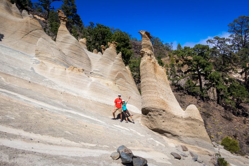
Tourists have to hike up winding mountain trails to the «Lunar Landscapes.» The entire route, starting from Vilaflor, takes about 13 km. You can drive along the TF-21 highway for another 2 kilometers towards Teide until the dirt road and then walk through the picturesque area, following the signs.
The Rock-Sanctuary – Roque Nublo on Gran Canaria
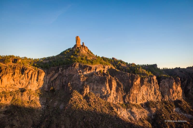
The center of the round island of Gran Canaria (Gran Canaria) is occupied by mountain landscapes. In the very heart of the massif, near the town of Tejeda, stands the famous «Rock in the Clouds» – the Roque Nublo (Roque Nublo) monolith. The top of this volcanic formation, resembling either an ancient idol or a stone finger, reaches 1.8 km above sea level. The solitary rock rises 80 meters above the surface of the ground. The indigenous Guanche people who lived on Gran Canaria in pre-Spanish times worshipped Roque Nublo, considering it a petrified deity that had descended from the heavens. Offerings were made at the foot of the solitary rock, and prayers were offered to it. Legends about the magical power of Roque Nublo still live on in the epic tales of Gran Canaria.
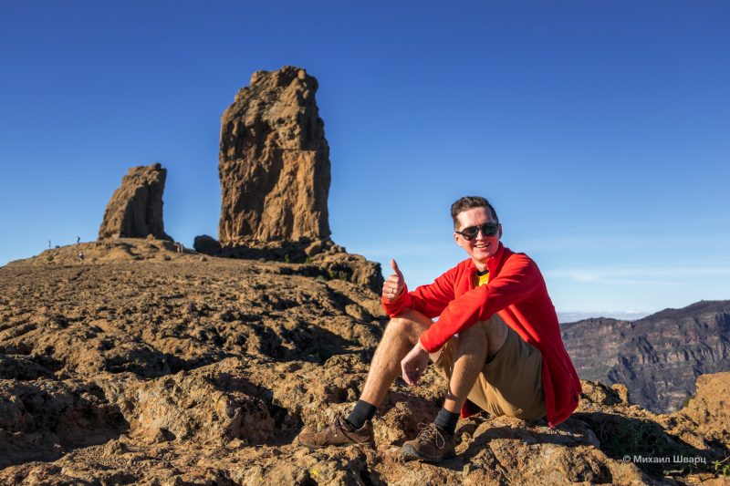
To reach the summit on which the monolith stands, you need to follow mountain paths from the main road. The length of the route is about 5 km over uneven, rocky terrain. Trekking trails lead from Tejeda, Arucas, and other nearby settlements. Following the route, you can see other unique rock formations: the «Monk» peak and the «Frog» rock.
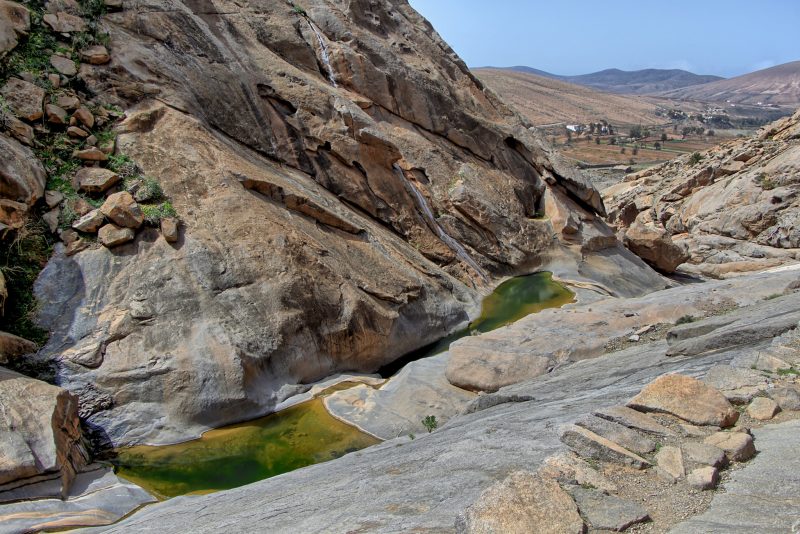
Las Peñitas Ravine on Fuerteventura
To see the Las Peñitas landscape, you need to get to Vega. From the town, you’ll have to walk along the FV-30 highway.

